Quick access: download and install, Google Earth Pro, see a street, change the date, see your house, go to Street View.
What is Google Earth?
Initially developed by the company Keyhole (now acquired by Google), Google Earth is a free software proposed by Google allowing to fly over any point of the Earth, on the ground or in aerial view. The user can browse the Earth through satellite images, in 2D or 3D. It is also possible to perform searches (restaurants, hotels, etc.) and to consult road routes.
What can I do with Google Earth?
Google Earth allows the user to see any place on the globe as satellites do. The resolution is not the same everywhere, but strategic places (big cities) are often very well covered, so much so that you can easily distinguish cars in the streets.
To use it, you just have to type a place name (sometimes specifying the country) to go there. The software downloads all the information from the Internet in real time: satellite images, street names, roads, cities, location of hotels, restaurants, etc.
In addition to the classic top view, it is possible to tilt the view angle and see the landscape in relief. The height of the view (altitude) is also adjustable. Of course, the map can be rotated.
The user can save places in memory and add comments.
Google Earth also offers routes to get from any point on the globe to another.
The versions of Google Earth
Google Earth is available in 3 versions:
- Google Earth on the web, directly in the Chrome browser
- Google Earth mobile, in an app
- Google Earth or Google Earth Pro, software to install on a computer
There are also other tools in addition:
- Google Earth Studio (software for computer)
- Google Earth Engine (on the cloud)
- Google Earth VR (on Oculus Rift)
- Google Earth Outreach (Earth Solidarity)
- Google Earth Education
For information, at its launch, the software existed in several versions (all of them had to be installed, none of them could be used directly in a browser):
- Google Earth free
- Google Earth Plus cost 20$ per year; it integrates the support of GPS devices, the import of data as spreadsheets, drawing tools and better printing functions
- Google Earth Pro was $400 per year; aimed at professionals for commercial use, it includes the enhancements of Google Earth Plus as well as area calculation and other options (video generator, high-end printing, GIS data import, etc.)
- Google Earth Enterprise was a set of solutions for businesses, which allow the deployment of commercial solutions in ASP or hosted mode (these are Google Earth Fusion and Google Earth Server).
Google Earth on the web
This version is very easy to use: just open Google Chrome! You can immediately travel around the world, virtually visiting hundreds of cities, including in 3D. A dice offers you to travel by drawing randomly the destinations…
For the moment this version is only available on Chrome, not on Firefox, Safari, Edge/Internet Explorer or Opera.
Google Earth on mobile
You can install the Google Earth app for mobile or tablet, it is available on Android and iOS.
Explore the entire world from above with 3D satellite images and terrain of the entire globe and 3D buildings in hundreds of cities around the world. Recently updated/added 100 3D cities including New York City, London, Paris and Amsterdam. New high-resolution images in parts of 21 countries.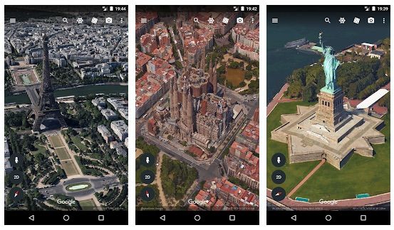
Zoom in on your home or anywhere else and then dive in for a 360° perspective with Street View. Go on a unique adventure by rolling the dice and jumping from place to place. And see the world from a new perspective with Voyager, a collection of guided tours from BBC Earth, NASA, National Geographic, and more.
Touch the ruler to calculate distances and areas anywhere on Earth.
Google Earth Pro on a computer
For more advanced use, install the pro version, it’s free! Available on Windows, MacOS and Linux.
Import and export GIS data, travel in time with archive images…
Google Earth Tips
How to download Google Earth for free?
This software is available in a lot of languages, you can download it for free in PC Windows, Mac or Linux version.
- to download Google Earth for computer, click here
- to download Google Earth Pro for computer, click here
Can I use Google Earth on a Mac?
Yes, of course! You can consult it directly in Google Chrome or install the application for MacOS.
How to install Google Earth pro (free)?
To install or update the software, download the application and launch the installation program. You will be guided through the steps necessary to install the software. The installation is standard, just do it as a computer administrator.
System requirements :
- on Windows PC: Windows 7 or later, 1 GHz processor or faster (2 GHz recommended), 2 GB memory (4 GB recommended), 2-4 GB free hard drive space, DirectX 9 (11 recommended) or OpenGL 1.4 (2 recommended).
- on Mac: MacOS 10.8 or later, 64-bit processor, 4 GB memory, 4 GB free hard drive space, OpenGL 2.
How to use Google Earth online (without installing anything)?
You just have to consult Google Earth in the Chrome browser (it doesn’t work in the others…) at earth.google.com/web
This version is also called “Google Earth for the web” or simply “Google Earth online”.
Why does Google Earth not work anymore?
Check here for support for the following problems:
- Solving problems in Google Earth
- I can’t sign in to my Google account
- How to fix blurry or outdated images
- How to fix crashes and display problems
- How to stop the globe from spinning
- How to delete files to free up memory space
- How to improve performance
Why is Google Earth not up to date?
You can enable automatic updates for Google Earth Pro during installation.
If you have not activated them, you must manually update the software by clicking here.
Google Earth Pro 6.0 and earlier versions are no longer available. Google Earth Pro 7.1.5 and earlier versions require a license key. If you don’t have one, please use your email address and the GEPFREE key to log in.
Which is the best version of Google Earth? Which one to choose?
The most efficient and simple is probably the Google Earth mobile app, but if you prefer not to install anything, just use Google Earth web (in Chrome). Only if you need advanced features should you install Google Earth Pro on your computer.
What is Google Earth Studio?
Earth Studio allows you to create animations using 3D and satellite images from Google Earth :
- Take advantage of a powerful graphical animation solution, integrated into your browser. Earth Studio gives you the tools you need to create professional content using Google Earth images.
- Keyframe animation: Earth Studio uses keyframes, just like other standard animation tools on the market. Simply move the globe, set a keyframe and repeat the process. Nothing could be easier!
- Template Project: With the different templates, you can create an orbit or fly from point A to point B very easily, even if you have no animation experience.
- Special Effects: Animate custom attributes such as the position of the sun, the camera’s field of view and other elements.
- 3D Camera Export: Easily add labels and markers to the map in post-production. Earth Studio allows you to export camera data to Adobe After Effects.
To use Earth Studio:
- go to the desktop version of Google Chrome
- sign in to your Google account
- fill out this form
- hope your request is accepted!
Please note that for the moment Earth Studio only works in Google Chrome.
How to use Google Earth
How to find a specific place in Google Earth?
To search for a location:
- Enter one or more terms in the input box and click Start Search.
- You can search by full address, or city only, or business name, or geographic coordinates (latitude, longitude) or just keywords.
How to see the street on Google Maps or Earth?
You have to use what Google Earth calls the 3D ground level view. In the software on your computer, in the side panel, under the heading “Layers”, click on “Main database” and then “3D Buildings”.
You will then be able to see the street and the buildings as if you were there!
How to see my house by satellite on the Internet? Which Google Earth?
You can use any version of Google Earth. Search for your address in the search engine of the application and you will see your house in satellite photo.
You can also see it in Google Maps, just select the satellite view layer.
How to find my house in Google Earth?
- Enter your address in the search field and click on Start Search
- In the search results, double click on your address
- Google Earth will take you to your neighborhood
- Drag Pegman to access Street View and get a closer look at your house
How do I get around in Google Earth?
- Use the view joystick (at the top of the navigation controls) to look around.
- Click and drag the ring to rotate the view.
- Use the navigation joystick (in the center of the navigation controls) to move up, down, left or right.
- Use the zoom slider to zoom in (+ sign) or out (- sign).
How do I calculate a distance in Google Earth?
In Google Earth Pro, you can measure a distance between 2 points, a perimeter or an area of land:
- In the menu bar, click on Tools then Ruler
- Select Mouse Navigation, bottom left.
- Click on the tab corresponding to what you want to measure.
- Hover and click on a location on the map to set the starting point for your measurement.
- Then move the mouse to another location and click to set an end point.
The measurement is displayed in the “Ruler” window, you can save it and give it a name. You will find it in the “Places” section of the left panel of the program.
How to find Area 51 in Google Earth?
Searching for “area 51” in the search form usually does not give good results. It is better to type “Groom Lake, Nevada” to find the secret American military zone, or more precisely “37.244833, -115.817222” which is approximately the address of Area 51.
For the record, here are the coordinates: 37° 14′ 06″ north, 115° 48′ 40″ west.
How to fly the plane in the Google Earth flight simulator?
To use the flight simulator, you need to install the Google Earth software.
To launch the simulator:
- in the menu: click on Tools then Access the flight simulator
- select a plane
- choose the place of departure of the flight
- configure your flight controller (joystick or mouse)
To fly the plane:
- Activate the Head-Up Display (HUD) to control everything that happens during the flight. Click Ctrl+h to get help during the flight.
- Try the joystick if you have one, it’s the easiest way
- Otherwise, follow Google’s instructions here to fly the plane with the computer mouse
How to put Google Earth in another language ?
For the software installed on Windows:
- go to “Tools > Options”.
- click on the “General” tab and then on “Language settings
- select the language of your choice or “System default” to use the language of your computer
For the software installed on Mac:
- go to the Apple menu
- click on “System Preferences” and then on “Language and Region”.
- choose the language of your choice
For Google Earth on the web, add ?hl=en (for english) at the end of the URL or go directly to ?hl=en
How to view Street View in Google Earth?
With the Street View feature available in Google Earth, you can dive from space to street level. Just like the web version of Google Maps, Google Earth software allows you to see photos of streets and virtually walk around in 3D. A very large number of countries already have Street View, as the famous Google cars have been crisscrossing the major cities (and countryside).
Here is how to do it:
- Zoom in on a location
- When Pegman appears in the navigation controls, drag it
- Drop it to use Street View
What is a layer and how do I display it?
In Google Earth, a layer shows geographic details overlaid on the map or satellite view.
- To display a layer, check a specific box or select the entire folder in the Layers panel.
- To hide a layer or layer folder, uncheck it.
- To expand or collapse a layer folder, click the ➡️ or ⬇️ arrows.
- Be aware that some layers only appear when you zoom in on the area of interest.
What is a custom tour and how do I use it?
You can save a custom tour and share it with other users.
- Click on “Save Tour” in the menu bar to display the save commands.
- Use the buttons that appear to start and end your recording.
- To review the visit, double-click on the name of the visit in the “Places” panel, then click on the “Start Visit” button.
How do I change the date and display images from the past?
To view historical images of geographic areas and see how places have changed over time:
- Click on the clock icon in the Google toolbar
- Move the slider that appears to go back in time and see historical images.
What are the main Google Earth features?
Search nearby
Google Earth includes the Google Maps search feature, which allows you to search for businesses and services in a particular area.
Routes
Click on the Routes tab to get a detailed roadmap. Enter an address, or click the “From this location” or “To this location” link in any of the information bubbles. Click on the Start Tour icon, similar to the button on a VCR, below the route. Google Earth will take you through the route.
Printing, saving and emailing
Google Earth allows you to print and save images, and send them by e-mail. For example, to email your route to a friend, you can send a file in JPEG format, or even in KMZ (Landmark) format, if they are a Google Earth user. Google Earth Pro allows you to print with a resolution of 2400 pixels, and even 4800 pixels with the Premium print option.
Save search results
If you want to revisit your search results, you can save a result row (or even the entire result folder) in the Places folder, along with custom icons and descriptions, and share them with your friends on Google Earth.
Displaying useful information
When you explore a place, you can get various useful information about it (stored in layers), such as roads, restaurants, parks and accommodations.
3D Buildings and Relief
With Google Earth, you can see the buildings of many cities, in 3D and “top-down”. Buildings data can be turned on in the Quick Info navigation panel. Tilt the image to see the buildings in 3D.
Also, the terrain is mapped in 3D, which means that it is possible to see mountains, valleys and canyons in Google Earth. Google has even modeled trees in 3D: more than 80 million have been planted with Google Earth version 6!
How to measure distances in Google Earth?
To know the distance between 2 places :
- Click on Measure in the Tools menu
- Choose the unit of measurement.
- In Google Earth Pro, it is also possible to measure the radius, the perimeter and the area (which is important for professional use).
Which satellite is used by Google Earth?
The 2 main satellites used by Google Earth are Landsat (from NASA) and SPOT (from CNES and ESA), Earth observation satellites.
You can see a large collection of images in Google Earth, including satellite, aerial, 3D and Street View images.
The images are collected over time from a number of providers and platforms. Satellite imagery providers include:
- the European Space Agency (ESA), CNES (Centre National d’Etudes Spatiales) and its SPOT satellites
- NASA and its Landsat satellite, the first space-based Earth observation program for civilian use
These satellite images are marketed by GeoEye, DigitalGlobe and Spotimages.
How old are the Google Earth photos?
Some photos show a unique acquisition date, defined by the image provider.
- If an image is a mosaic of several satellite or aerial photos taken over several days or months, a date range with a start and end date is displayed to show the dates between which the images were taken.
- If the data provider provides little or no date information, a start and end date is shown for the period in which the image was taken.
Google Earth’s satellite and aerial images are taken by cameras on board satellites and aircraft. All images are collected at specific dates and times, then used in Google Earth as a single image with the specific collection date. But :
- Images are sometimes combined into a mosaic of images taken over several days or months. These images are displayed as a single image and the date may change as you move your cursor over the map.
- The information on image collection is sometimes limited. In this case, the date displayed reflects the beginning of a date range where the image was probably taken.
- When the “3D Buildings” layer is enabled, detailed terrain and building images are derived from aerial images collected over several dates, so Google Earth does not display a collection date.
- Collection date information is lost or inaccurate due to human error or other problems.
Other questions
💻 How do I install Google Earth on computer?
Download the installer (instructions here), then run it and follow the instructions. The software works on Windows PC, Mac or Linux.
👀 How to view a street with Google Earth?
Use the 3D ground level view feature (click here to find out how). It’s very convenient, you can see the street and buildings as if you were there!
📅 How to change the date of Google Earth?
It is possible to go back in time! To view historical images of geographical areas and see how places have changed over time, click here.
🏠 How can I see my house on Google Earth?
It’s very easy! Follow these explanations to use the search engine and find your address and see your house in photos, including in Street View mode.
🤳 How to go on Google Street View?
The Google Earth software offers to see photos of streets and to walk virtually in 3D in them, thanks to Street View. Follow these very simple instructions…
🌍 Is Google Earth Pro free?
Yes! From now on Google Earth Pro is free, you can follow these instructions to install it (only on computer, on Windows, MacOS or Linux).